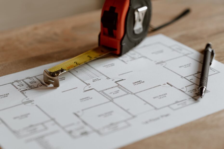
A zoning map assigns your parcel to a district with limits on land use, building size, placement, and activity. A backyard studio, rental conversion, or second story can conflict with a setback, height cap, parking rule, or permitted-use standard.
You can use the map, ordinance, and local staff review to check a purchase, renovation, rental plan, ADU, garage, or business proposal before money goes toward plans or construction.
Zoning Sets Land-Use Rules for Homes
A street can hold detached houses on one block, shops on the next, and warehouses farther away because zoning separates activities with different impacts. Your parcel sits inside a zoning district, a mapped area that governs what can occupy the land and how intensely the land can be used.
Zoning is a local government system that assigns land to districts and regulates development within them. It limits conflicts such as late-night truck traffic beside bedrooms while helping cities and counties plan roads, water lines, fire access, drainage, and school capacity.
District Families Sort Land by Broad Use
Three categories appear on many zoning maps: residential, commercial, and industrial. Residential zoning covers homes and housing density, commercial zoning covers stores and offices, and industrial zoning covers manufacturing, storage, freight, or heavy service activity.
| District family | Typical land use | What it can mean for your home |
|---|---|---|
| Residential | Houses, townhomes, apartments | Your unit count, setbacks, parking, and height can face tight limits. |
| Commercial | Stores, offices, restaurants | A house can face residential-use limits or added conversion standards. |
| Industrial | Warehouses, fabrication, freight yards | Housing can be barred, restricted, or treated as a nonconforming use. |
| Agricultural | Farming, livestock, rural homes | Your lot can allow larger parcels, barns, animals, or farm-related activity. |
| Mixed-use | Homes with shops or offices | You can find apartments over retail, live-work space, and shared parking rules. |
Mixed-use zoning places homes and businesses near each other, while agricultural zoning preserves rural patterns or farming activity. A comprehensive plan can guide map choices, but the zoning ordinance contains the enforceable parcel-level standards that affect your project.
Your district name alone does not settle what the lot allows. The map gives you a starting point; the written code supplies the standards for your address.
A Zoning Map and Ordinance Identify Parcel Rules
A colored parcel layer can point toward an answer in minutes, yet the map is only a starting point. Your city planning department or county planning office keeps the zoning map and ordinance, and both records need to match before you rely on a district label.
Parcel Research Follows a Short Sequence
- Find the GIS map. Search the city or county site for its parcel viewer or zoning map, then enter your street address.
- Record the district code. Copy the district label, parcel number, overlay name, and map date into your project file.
- Open the ordinance. Locate the district chapter, permitted-use table, dimensional standards, parking rules, and definitions section.
- Check overlay layers. Look for floodplain, historic, airport, shoreline, wildfire, or neighborhood-plan layers affecting your lot.
- Contact planning staff. Ask staff for written confirmation before you spend on plans, surveys, or deposits.
Your search for how to find a property’s zoning should end with staff confirmation rather than a map screenshot. Online maps can lag behind an adopted amendment, and a thin boundary line can place neighboring lots under sharply different rules.
District Labels Need Local Definitions
R-1 can mean detached homes on large lots in one place, while another city uses R-1 for several housing forms. R-2 can allow duplexes, two-family homes, or smaller lots, but letters and numbers do not carry one national meaning.
RM can signal residential multifamily use, and C-1 can signal a lower-intensity commercial district. Labels such as R-3A, R-2/HO, or C-1D can point to subdistricts, historic overlays, design rules, or special conditions.
A map result is not a permit decision. Bring your parcel address, district code, and a plain-language project description to the planning office before treating a use as allowed.
Jurisdiction also changes at municipal borders. An incorporated city writes and enforces its own code, while a county can control unincorporated land. Texas has no single statewide residential zoning code, so your answer comes from the city or county with jurisdiction over the parcel.
Once you have the local code, dimensions matter more than a district name. A residential label can still place hard limits on the shape and scale of your project.
Residential Districts Control Use, Size, and Placement
A 12-foot side-yard line can stop an addition before a designer finishes the floor plan. Residential zoning rules regulate housing type and unit count, but they also set the physical envelope around your home, from its footprint to its roof peak.
Dimensional Rules Shape the Lot
| Rule | What it measures | Project consequence for you |
|---|---|---|
| Minimum lot size | Land area required per dwelling | A split lot or added unit can fail before design review begins. |
| Density | Homes allowed per acre | Your parcel can allow one dwelling where a larger tract allows several. |
| Setback requirements | Distance from lot lines or streets | An addition, shed, deck, or garage can cross the allowed yard. |
| Lot coverage | Portion of land covered by structures | A new garage can push roofs and paved areas above the cap. |
| Floor-area ratio | Floor area relative to lot area | Your second level can exceed the allowed building density. |
| Height limits | Maximum building height | A raised roof, dormer, or second story can need redesign. |
| Parking and open space | Vehicle spaces and unbuilt land | A conversion can trigger parking loss or yard-area conflicts. |
Lot coverage and floor-area ratio measure different parts of a building. Coverage tracks ground area under roofs, while FAR counts total floor area, so a two-story addition can meet coverage limits yet exceed FAR.
Overlays Add Another Set of Limits
Your base district is not always the full answer. A historic district can regulate window patterns, exterior materials, demolition, and roof form; a floodplain overlay can limit fill, floor elevation, or rebuilding after storm damage.
Neighborhood plans can add design review, tree retention, frontage standards, or parking rules. In Portland and Savannah, district standards work beside overlays and local design controls rather than replacing them.
Those added layers explain why a project that fits the base district can still need planning review. Your next step depends on whether the work stays within routine standards or needs discretionary land-use approval.
Home Projects Follow Different Zoning Paths
A detached shed and a garage conversion can occupy similar square footage yet follow different review paths. The main distinction is whether your proposal is permitted by right under district rules or needs separate land-use permission.
Routine Work Still Faces Site Standards
A use permitted by right means the ordinance allows it without a discretionary land-use hearing, provided the proposal meets every applicable standard. You still need to meet setbacks, height, coverage, drainage, parking, and building permit requirements before construction starts.
| Project | Frequent zoning issue | Likely path |
|---|---|---|
| Rear addition | Rear-yard setback or lot coverage | Permit review, survey check, or variance request |
| Fence | Front-yard height and corner visibility | Site rule review before installation |
| Deck | Setback measured from deck edge | Permit review and dimensional check |
| Detached garage | Accessory-structure location and height | Site plan review and construction permit |
| Rebuild after damage | Nonconforming status or flood rule | Planning determination before reconstruction |
For example, a 10-by-16-foot shed can fit a rear yard but violate a five-foot side setback. Your survey, rather than a tape measure against a fence, identifies the legal lot line used during staff review.
Use Changes Receive Closer Review
An accessory dwelling unit can trigger unit-count limits, owner-occupancy rules, parking standards, entrance rules, and utility requirements. Your garage conversion can count as a new dwelling unit even though its walls already stand.
Duplex conversion, short-term rental activity, long-term leasing, home businesses, and lot subdivision each change use or intensity. A quiet office with no customer visits can fit a home-occupation rule, while equipment deliveries, employee parking, or exterior signs can place the activity outside it.
Do not assume a building permit settles land use. A permit reviewer can require zoning clearance, and a zoning-clearance letter can still leave structural, electrical, drainage, or fire work for later review.
Land use and construction safety answer separate problems. Treating them as one process can delay work and force changes after plans are drawn.
Zoning Is One Layer of Property Regulation
A roof addition can meet height limits yet fail structural requirements for rafters, wind loads, stairs, or emergency escape. Zoning controls where and how intensely land is used, while building codes control the safety and technical details of the work.
Public Controls Run on Separate Tracks
| Control | Main focus | Example affecting your project |
|---|---|---|
| Zoning ordinance | Use, location, scale, density | Rear addition must stay outside a setback. |
| Building code | Safety and construction methods | New bedroom needs compliant egress and smoke alarms. |
| Building permit | Permission to start regulated work | Framing and electrical plans face plan review. |
| Inspection | Field verification during work | Foundation, rough wiring, and final work receive checks. |
| Environmental or utility review | Water, sewer, drainage, habitat, service capacity | An ADU can need a sewer-capacity or drainage review. |
After zoning clearance, your project can still need grading approval, septic review, stormwater paperwork, utility connection work, or fire-access review. A rural parcel with a private well and septic system can face county health rules absent from the zoning chapter.
Private Limits Can Exceed Public Rules
Your HOA covenants, deed restrictions, easements, and recorded plat notes operate as private property limits. Zoning can allow a six-foot fence while a covenant limits its material, location, or height, and an easement can bar structures across a utility corridor.
Property transfer does not erase recorded limits. Check title documents, subdivision declarations, and plat records before you count on a side yard, rear strip, or shared drive as usable project space.
Once the full set of limits is clear, you can identify the actual source of a conflict. The proper remedy depends on whether the issue involves a measurement, a conditional activity, or the zoning district itself.
Approval Type Depends on the Problem With the Plan
A three-foot setback shortfall needs a different remedy than a prohibited duplex. Your request needs to match the reason the proposal fails because a local zoning board cannot use a variance to bypass every district restriction.
Each Approval Path Solves a Different Problem
| Path | Problem it addresses | What you need to show |
|---|---|---|
| Variance | A dimensional hardship tied to the parcel | Physical site conditions make strict compliance unusually difficult. |
| Conditional use permit | A listed use needing case-by-case review | Your plan meets stated findings and operating conditions. |
| Special exception | A use allowed through a board process | Your proposal meets ordinance criteria for that exception. |
| Rezoning | The district bars the intended use | A map change fits local policy and surrounding land-use patterns. |
A variance gives relief from dimensional rules such as setbacks, lot width, parking count, or height limits. It usually requires a hardship tied to the land, such as an oddly shaped lot, steep slope, or preexisting street alignment rather than a preference for a larger room.
Your variance request rarely authorizes a land use barred by the district. A single-family district that bars duplexes does not become a duplex district because a side-yard variance was granted.
Conditional Review Can Set Operating Limits
A conditional use permit or special exception applies where the ordinance lists a use but requires discretionary review. A planning commission or zoning board can set limits on hours, parking, lighting, occupant count, access, screening, or annual review.
Rezoning reaches farther because it changes the parcel’s district classification through a legislative process. Your request can face staff analysis, neighbor notice, public hearings, and a governing-body vote, with the comprehensive plan serving as a policy reference.
A map change can affect future options even after an existing house stays in place. A lawful older use can continue, but its ability to expand or return after damage can narrow.
Rezoning and Nonconforming Uses Affect Long-Term Options
A house does not lose legal status on the day a map amendment changes its district. A lawful existing home or activity that no longer matches new rules can continue as a legal nonconforming use, sometimes called grandfathered status, subject to local limits.
Rezoning Follows a Public Sequence
- Pre-application meeting. Bring your concept, parcel map, and proposed use to planning staff for an initial code review.
- Application filing. Submit forms, fees, legal description, site material, and any required justification narrative.
- Staff review. Planning staff review consistency with the comprehensive plan, utilities, access, and surrounding uses.
- Neighbor notice. Mailed notice, posted signs, or newspaper notice alerts nearby owners under local procedure.
- Planning commission hearing. The commission reviews staff findings and public comments before making a recommendation.
- Governing-body vote. A city council, county board, or similar body makes the final legislative decision.
Your timeline can run from weeks to several months, based on hearing schedules and application completeness. A denial leaves the existing district intact, while an adopted rezoning can add conditions through a planned development agreement or ordinance text.
Grandfathered Status Has Boundaries
Nonconforming status can protect continued occupancy, but it does not always protect expansion. Local rules can limit enlargement, require a use to stop after abandonment, restrict conversion to another nonconforming use, or bar rebuilding beyond a stated damage threshold.
For example, an older duplex in a district now limited to detached homes can remain occupied as a duplex. Your plan to add two bedrooms, rebuild after a fire, or convert the structure into four units can trigger rules the prior owner did not face.
Property transfer alone does not usually end lawful nonconforming status, but proof matters. Keep permits, tax records, leases, dated photographs, and prior planning letters that show how the property operated before the code changed.
Do not rely on a real-estate listing that calls a property grandfathered. Ask planning staff for a written determination stating the recognized use and limits on repair, enlargement, or reconstruction.
Long-term options become clearer after you verify that history. The same discipline protects you before a contract, remodel, or rental conversion turns a zoning assumption into a costly commitment.
Pre-Project Research Protects Your Budget and Schedule
A contractor can draw a strong plan for a room that cannot fit inside your legal building envelope. Before you buy land, sign a contract, or hire design help, identify the intended use and check it against the district, overlays, and recorded limits.
Due Diligence Puts Key Facts in Writing
- Verify the parcel. Match the street address, parcel number, legal description, and map district before relying on online information.
- Read district standards. Pull permitted uses, lot dimensions, setbacks, height limits, parking, and accessory-structure rules from the ordinance.
- Check overlays. Search flood, historic, airport, shoreline, design, and neighborhood-plan layers that add separate restrictions.
- Describe the project. State the proposed use, floor area, location, height, parking, and occupancy rather than asking a vague question.
- Request written direction. Ask the planning office for a written interpretation where code language leaves room for disagreement.
- Price the full path. Include surveys, plans, hearings, permit fees, utility work, drainage work, and redesign time in your budget.
Your project has tradeoffs beyond the parcel. Zoning can give you predictable separation from incompatible activity and help a neighborhood plan infrastructure, yet restrictive rules can limit new homes, smaller lots, added units, and housing supply.
Large minimum lots, bans on multifamily housing, and narrow rental rules can restrict who can live near jobs, schools, transit, or family networks. Those effects can arise even where a local rule cites neighborhood stability as its purpose.
Contact the local planning or zoning office with your parcel address, a short project description, and every map or code reference you found. Do that before a contract deadline or builder deposit rather than after plans are set.
Key Takeaways
Your zoning designation is a starting point rather than a final answer. Read the ordinance, overlays, private records, and permit requirements together, then match any conflict to the right path: redesign, variance, conditional review, or rezoning.
Careful verification gives you a usable answer before money and momentum make changes harder. Your written records can also help during future refinancing, resale, reconstruction, or dispute review.
FAQ
What are the three main types of zoning?
Residential, commercial, and industrial districts are the three broad categories you will encounter most often. Residential districts regulate homes and density, commercial districts cover business activity, and industrial districts cover heavier work or storage. Agricultural and mixed-use districts add other patterns in local codes.
What does zoning mean in housing?
Zoning in housing means local rules control the homes, uses, and physical dimensions allowed on your parcel. Your district can regulate unit count, lot size, setbacks, building height, parking, lot coverage, rentals, accessory structures, and business activity from the home.
How do I find the zoning designation for my house?
Start with your city or county parcel GIS map and record the district code shown for your address. Then open the local zoning ordinance, check overlays, and ask the planning department to confirm the designation and relevant rules in writing before relying on the result.
What can I build on my property under residential zoning?
Your district text identifies allowed homes, additions, garages, sheds, decks, fences, and accessory dwelling units. Size and placement still matter because a permitted structure can fail after it crosses a setback, exceeds height limits, takes too much lot coverage, or lacks required parking.
Can I run a business, build an ADU, add a garage, or rent out my house under local zoning rules?
Your code controls each activity separately. A home business can face customer-visit and sign limits; an ADU can face unit-count and parking rules; a garage faces height and location standards; and rental activity can face separate local registration or use limits.
What happens after a house gets rezoned?
New district rules can limit future additions, conversions, rentals, or redevelopment on your parcel. A lawful existing home or use can continue as a legal nonconforming use, but local code can limit enlargement, rebuilding after major damage, abandonment, or a change to another use.